

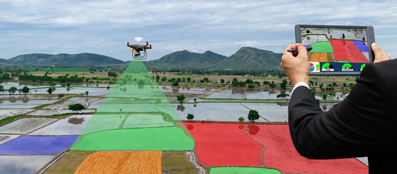
Have you ever wondered how we could collect data from above rather than the ground? Drone mapping is here to change the game. By using drones, we can gather information quickly and safely, making it a great alternative to traditional ground methods. Businesses are getting smarter thanks to this innovative technology, also known as UAV mapping.
But what is drone mapping, exactly? It's all about flying drones to snap photos from above. These pictures are then pieced together to create maps and 3D models. It's a powerful tool for many industries, from construction sites to farms, giving us new ways to view and understand our surroundings.
The interest in UAV mapping is booming, with more people wanting to know what it's used for and how to do it right. This guide will cover everything you need to know about drone mapping, including the best drones for the job and the essentials for getting started.
Try Recoverit to Recover Drone Data
![]() Security Verified. Over 7,302,189 people have downloaded it.
Security Verified. Over 7,302,189 people have downloaded it.
In this article
Part 1: What is Drone Mapping?
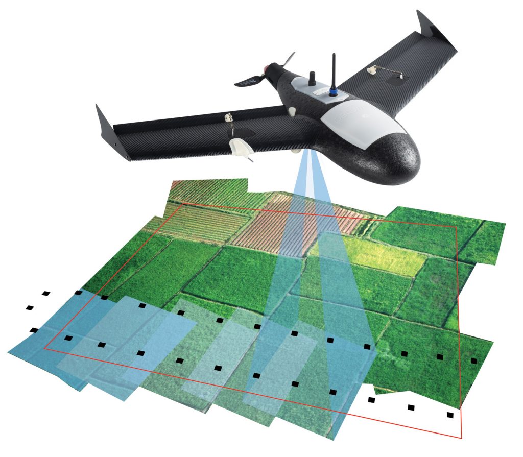
Drone mapping means using drones (UAVs) to capture images of land from above. The drone flies in a pattern and takes many pictures. Software then joins these pictures to make maps or 3D models. What is drone mapping if not a faster way to survey land?
What is UAV mapping? It's the same as drone mapping - UAV just means "unmanned aerial vehicle". The drone carries a camera or sensor that looks down at the ground. It takes hundreds or even thousands of pictures during flight. Each picture has GPS data to show where it was taken.
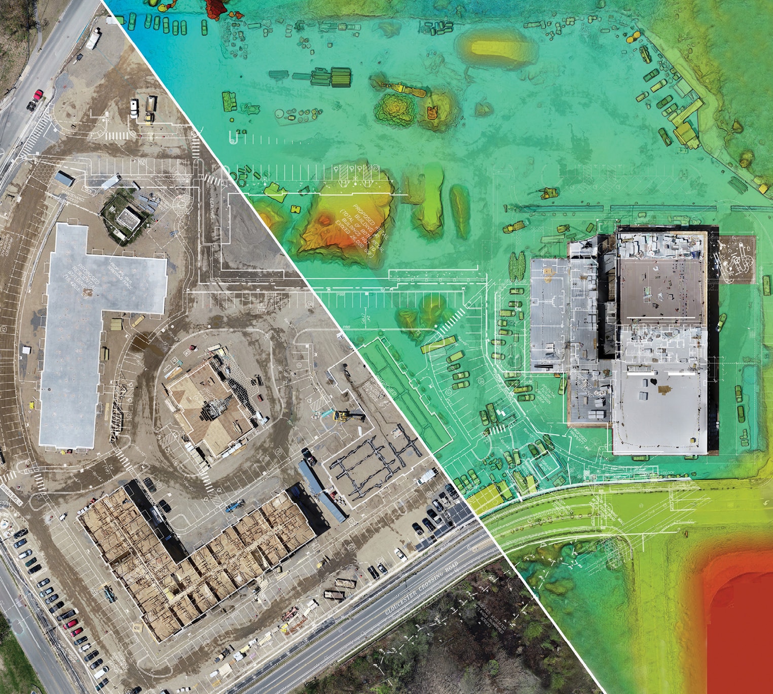
Drone mapping creates different outputs than regular photos. You get orthomosaic maps (flat, scaled images), 3D models, point clouds, and more. What is drone surveying? It's using drones to measure and map land accurately. This is much faster than traditional ground surveys.
Part 2: What is Drone Mapping Used For?
What is drone mapping used for? Many industries now use drone mapping to work better. Drone mapping helps people see, measure, and plan with better data. Here are the main uses:
- Agriculture: Monitoring crop health, mapping fields for irrigation, and assessing yield.
- Construction: Surveying land, monitoring progress, and creating 3D models of sites.
- Environmental Monitoring: Tracking landscape changes, monitoring wildlife, and assessing natural disasters' impact.
- Real Estate: Creating aerial views, generating 3D models, and providing virtual tours.
- Mining: Surveying sites, monitoring stockpiles, and ensuring safety compliance.
- Forestry: Mapping forest areas, monitoring tree health, and planning conservation efforts.
- Infrastructure: Inspecting bridges and roads, monitoring infrastructure health, and urban planning.
- Utilities: Inspecting power lines, pipelines, and other critical infrastructure.
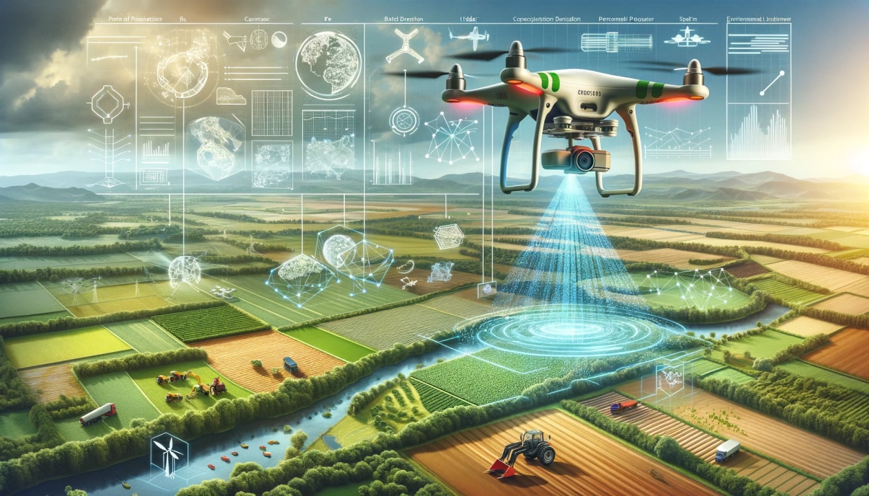
Part 3: How to Do Drone Mapping?
How to do drone mapping? First, you need a drone with a good camera, mapping software, and a flight plan. The mapping process turns simple drone photos into useful maps. Your first drone mapping project might seem hard, but the steps are simple to follow.
What is drone mapping's basic workflow? It starts with planning and ends with processed data. The quality comes from good flight settings and ground control points for drone mapping.
Here are the main steps:
- Plan Your Flight - Mark the area on a map app
- Set Flight Parameters - Choose height, overlap, and speed
- Place Ground Control Points - Put markers at known locations
- Fly the Drone - Let it follow the automatic flight path
- Capture Images - The drone takes pictures at set points
- Process the Data - Upload images to mapping software
- Create Maps and Models - The software makes your maps
- Analyze Results - Measure, annotate, and share your maps
Part 4: What is the Best Drone for Mapping?
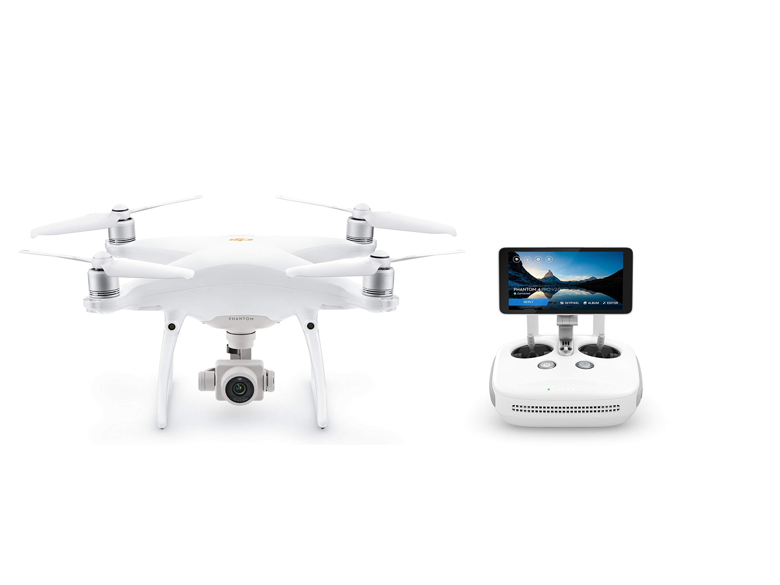
What is the best drone for mapping? For beginners, the DJI Phantom 4 Pro and Mavic series work well. These drones have good cameras, stable flight, and work with mapping apps. The Phantom 4 RTK is better for more accurate work. What is the best drone for surveying? It depends on your needs and budget.
For professional mapping, look at the DJI Matrice series or senseFly eBee. What is the best drone for mapping large areas? Fixed-wing drones like the eBee can cover more ground. For detail work, the DJI Phantom 4 RTK gives survey-grade results. The right drone makes your mapping work much easier.
Part 5: Recover Lost Data From Drone SD Card with Recoverit Tool
Sometimes you might lose drone mapping data. Your SD card might fail during a big project. Don't worry! You can recover lost data from drone SD card using data recovery tools. Wondershare Recoverit is one top option for drone recovery.
What makes Recoverit Good for Data Mapper Drone Users?
Recoverit is an excellent tool for data mapper drone users for several reasons:
- Photo and Video Recovery: Recoverit can find and restore photos and videos, even from damaged SD cards. This is crucial for drone users who often rely on SD cards to store their mapping data.
- Support for All File Types: This tool helps with the recovery of all file types. Whether it's images, videos, or other data files, Recoverit can handle it.
- High Success Rate: Recoverit boasts a high success rate in data recovery. This means that users have a better chance of retrieving their lost data.
- Preview Before Recovery: Recoverit allows users to preview the files before recovery. This ensures that users can select the exact files they need to recover.
These features make Recoverit a valuable tool for data mapper drone users, ensuring that their valuable data can be recovered efficiently and effectively.
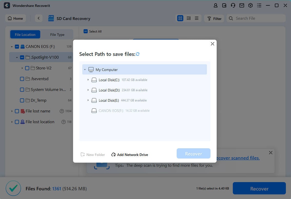
Steps to recover lost data from drone SD card:
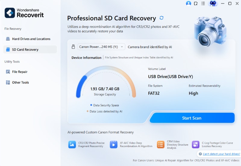
- Download and install Recoverit on your computer. Connect your drone's SD card via a card reader. Select the SD card as your recovery location.
- Click Scan to begin scanning.
- Preview found files from your drone.
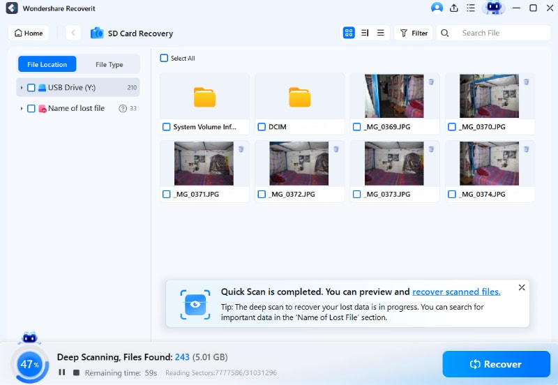
- Select the mapping images you want to recover. Click Recover to save your drone mapping data.
Related Video >>: How to Recover Files from Drone SD Card?
Part 6: Tips to Mark Ground Control Points for Drone Mapping
Ground control points for drone mapping are crucial for accuracy. These are marked points on the ground with known coordinates. They help tie your drone images to real-world locations.
Here are tips for using them:
- Choose High-Contrast Markers: Use bright colors like orange or white to make the GCPs easily visible from the air. Checkerboard patterns or large X-shapes work well.
- Ensure Clear Visibility: Place GCPs in open areas without obstructions like trees or buildings. This ensures they are visible in the drone's imagery.
- Distribute Evenly: Spread GCPs evenly across the mapping area. This helps in achieving consistent accuracy throughout the map.
- Vary Elevations: Place GCPs at different elevations if the terrain is uneven. This helps in accurately capturing the topography.
- Use High-Precision GPS: Measure the coordinates of GCPs using high-precision GPS equipment. This ensures the accuracy of the reference points.
- Mark the Center Clearly: Ensure the center of each GCP is clearly marked. This can be done with perpendicular lines or a distinct shape.
- Avoid Temporary Markers: Use durable materials for GCPs to ensure they remain in place throughout the mapping process.
- Record Coordinates Accurately: Keep a detailed record of the coordinates of each GCP. This helps in georeferencing the drone imagery accurately.
By following these tips, you can ensure that your ground control points are effective and improve the accuracy of your drone mapping projects.
Conclusion
Drone mapping has changed how we capture and use spatial data. What is drone mapping? It's a powerful way to see the world from above and make decisions with better information. From construction to farming, drone mapping helps work get done faster, safer, and with more accuracy.
What is UAV mapping going to look like in the future? The technology keeps improving. Drone mapping will become more automated and accurate. More businesses will use it as they see what drone mapping is used for. Learning how to do drone mapping now puts you ahead in many fields.
Whether you're just starting or already using drones, keep learning. Know what is the best drone for mapping your specific needs. Practice good techniques with ground control points for drone mapping. And remember that if things go wrong, you can recover lost data from drone SD card. Drone mapping isn't just a tool—it's a new way to see and understand our world.
Try Recoverit to Recover Lost Data from Drone SD Card
![]() Security Verified. Over 7,302,189 people have downloaded it.
Security Verified. Over 7,302,189 people have downloaded it.
FAQ
-
What is drone mapping accuracy without ground control points?
Without ground control points, drone mapping accuracy is 1-3 meters. Ground control points are reference points on the ground. They have known coordinates that the drone uses to correct mapping data. With these points, accuracy improves to 1-3 centimeters. This depends on the drone's GPS quality, flight altitude, and terrain. -
What is the best drone for mapping on a budget?
DJI Mavic Air 2: Has a 48MP camera. Can shoot 4K videos at 60fps. Flight time is 34 minutes. DJI Mini 2: Compact and portable. Offers 12MP photos and 4K videos. Flight time is 31 minutes. -
How can I recover drone footage if my drone is physically lost?
Some drones upload low-resolution previews to your phone. Check your device.- Use the drone's last known GPS coordinates.
- Try the return-to-home function to bring the drone back.
- Look for services that help recover lost drones.
 ChatGPT
 Perplexity
 Google AI Mode
 Grok
Grok


