

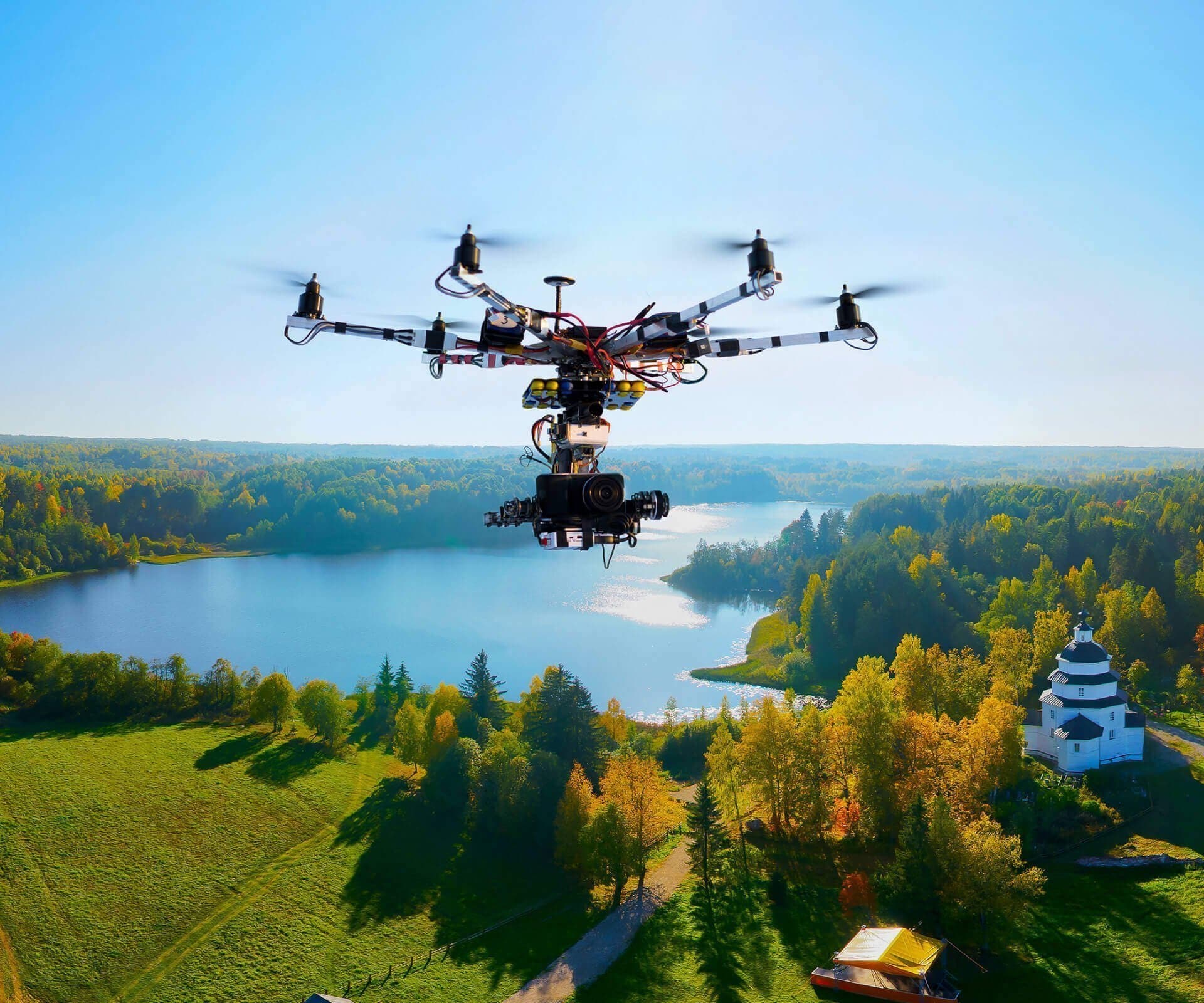
Drone imagery has changed how we see the world from above. Using drones for taking pictures and videos gives us a new way to look at things. Drone imagery services are now used in many fields. From checking buildings to helping farmers, drone imagery is becoming more common.
Aerial imaging with drones is easier and cheaper than using planes or helicopters. Many businesses now use drone imagery to save time and money. The drone imagery market is growing fast. More people are finding new ways to use aerial imagery drones in their work.
Thermal imagery drones can see heat differences that normal cameras miss. This makes drone imagery useful for finding problems in buildings or locating missing people. As drone technology improves, the uses for drone imagery services keep growing. This article will tell you all you need to know about drone imagery and aerial imaging.
Try Recoverit to Recover Drone Data
![]() Security Verified. Over 7,302,189 people have downloaded it.
Security Verified. Over 7,302,189 people have downloaded it.
In this article
Part 1: What is Drone Imagery?
Drone imagery is the process of taking photos or videos using cameras on unmanned flying devices called drones. These pictures can be from straight above or at an angle. Drone imagery captures views that would be hard or costly to get any other way. The images from drone imagery can be used to make maps, 3D models, or just beautiful pictures.
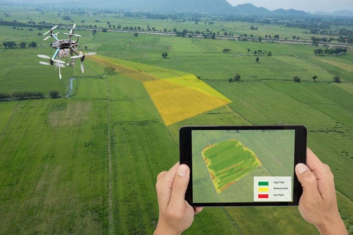
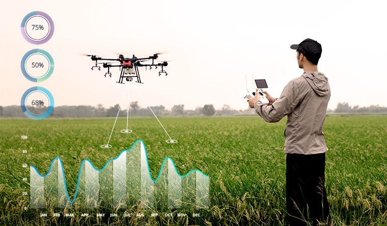
Drone imagery services use special equipment on drones to take high-quality images. This might include normal cameras, thermal imagery cameras, or other sensors. The drone imagery can be processed with software to create useful data.
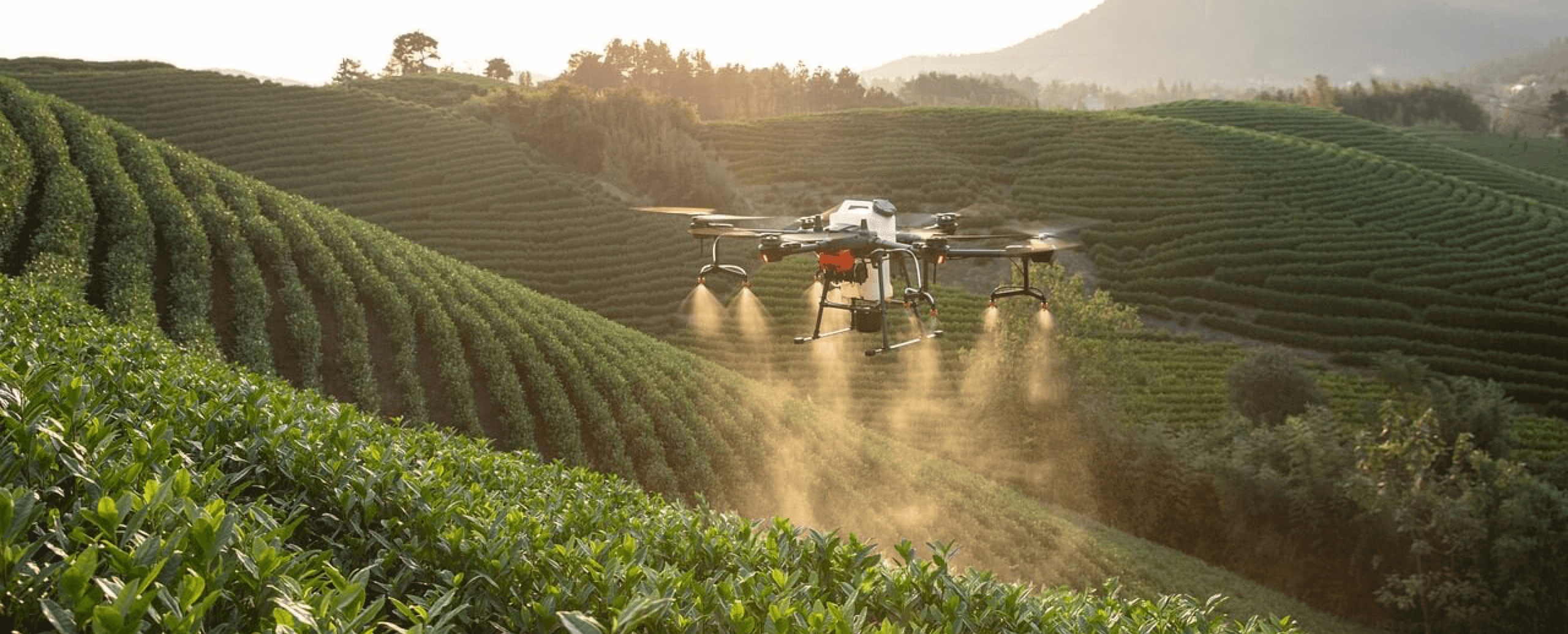
Many industries now rely on drone imagery for tasks like checking power lines, monitoring crops, drone mapping or creating marketing materials.
Part 2: What is Aerial Imaging?
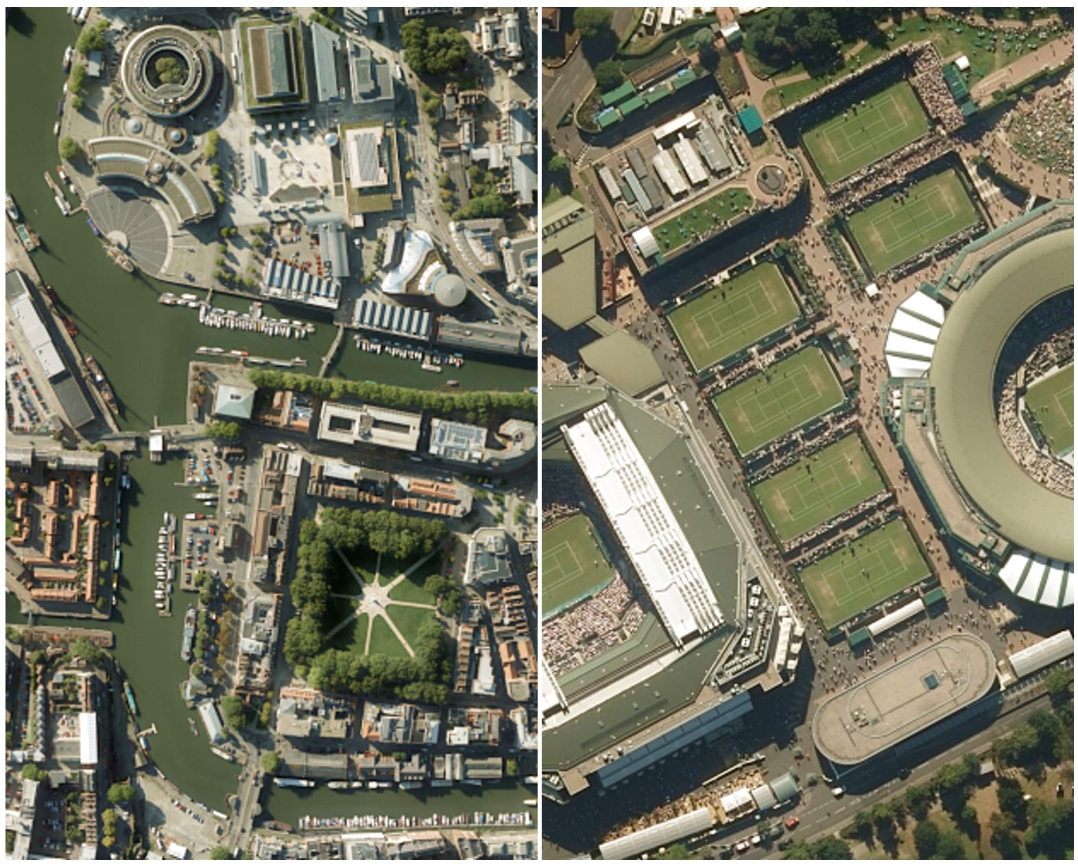
Aerial imaging means taking pictures from above the ground. This was once done only with planes, helicopters, or satellites. Now, aerial imagery drones do this job better and cheaper. Aerial imaging gives us views we can't get from the ground. It shows patterns and features that are hard to see otherwise.
What is aerial imaging used for? It helps map large areas, check progress on building sites, and look at land changes over time. Aerial imaging is useful for planning, monitoring, and inspecting. The images can be very detailed, showing objects as small as a few inches across.
Aerial imaging with drones is different from traditional methods. Drones can fly lower and get better pictures. They can also visit the same spot often to track changes. Aerial imagery drones are easy to use and don't need runways or special fuel. This makes aerial imaging more available to more people and businesses.
Part 3: Benefits of Using Drone Imagery Services
Drone imagery services offer many advantages over traditional aerial photography. These services use skilled pilots and good equipment to get the best results. Here's why many people choose professional drone imagery services:
- Cost-effective: Drone imagery is much cheaper than hiring planes or helicopters.
- Fast results: Drone imagery services can often deliver images the same day.
- High resolution: Modern drone imagery gives very clear, detailed pictures.
- Flexible scheduling: Drone imagery services can work around weather and time needs.
- Safe inspections: Drone imagery lets you check dangerous areas without risk to people.
- Regular monitoring: Drone imagery services can visit the same place often to track changes.
- Multiple view types: Services can offer normal photos, thermal imagery drone scans, and 3D models.
- Expert analysis: Many drone imagery services help understand what the images show.
Part 4: Why Use an Aerial Imagery Drone?
An aerial imagery drone gives you a new perspective on any project or property. These tools have changed many industries by making aerial views easy to get. Here's why you might want to use an aerial imagery drone:
- See the big picture: Aerial imagery drones show how things connect across larger areas.
- Save time: Checking large areas with an aerial imagery drone takes minutes instead of hours.
- Easy to use: Modern aerial imagery drones have simple controls anyone can learn.
- Reach difficult places: Aerial imagery drones can fly where people can't easily go.
- Create impressive visuals: Drone imagery makes properties and projects look their best.
- Track progress: Regular aerial imagery can document how projects change over time.
- Plan better: Aerial imagery helps with making smart decisions about land use.
- Quick response: An aerial imagery drone can quickly check problems after storms or other events.
Part 5: Accidentally Lost Data From Drone? Use Recoverit Tool!
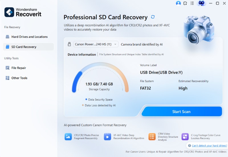
Data loss can occur even with top-notch drone imagery services. Memory cards might fail, or files can get accidentally deleted. Data recovery tools like Recoverit are useful in these situations. They can recover lost drone imagery from SD cards, hard drives, and other storage devices.
Recoverit supports various file types used in drone imagery. It can recover photos, videos, and project files. This makes it a versatile tool for any drone enthusiast or professional.
Ensuring your data is safe and recoverable is crucial. Always back up your files and consider using reliable recovery tools. It can save you from losing valuable imagery and work.
Here are some key features of Recoverit useful for drone imagery services:
- Versatile File Recovery: Recoverit can retrieve data from various scenarios, including accidental deletion, formatted drives, partition loss, virus attacks, system crashes, and even corrupted or inaccessible drives.
- Wide Device Compatibility: The software is compatible with a plethora of storage devices and media, such as HDDs, SSDs, external drives, SD cards, USB drives, digital cameras, camcorders, and drone cameras.
- Enhanced Photo and Video Recovery: This mode thoroughly scans the storage device to find more data remnants and attempts to repair damaged parts, including UHD, 4K, or 8K video clips.
- System Crash Recovery: Recoverit specializes in recovering files from a corrupted or unbootable system, which is crucial for businesses and individuals who cannot afford to lose important work in the event of a system failure.
- Deep Scan Technology: The software's deep scan function can search for traces of data even in the most challenging recovery situations, offering a more thorough retrieval process.
These features make Recoverit a powerful tool for ensuring your drone imagery is safe and recoverable.
The process is simple:
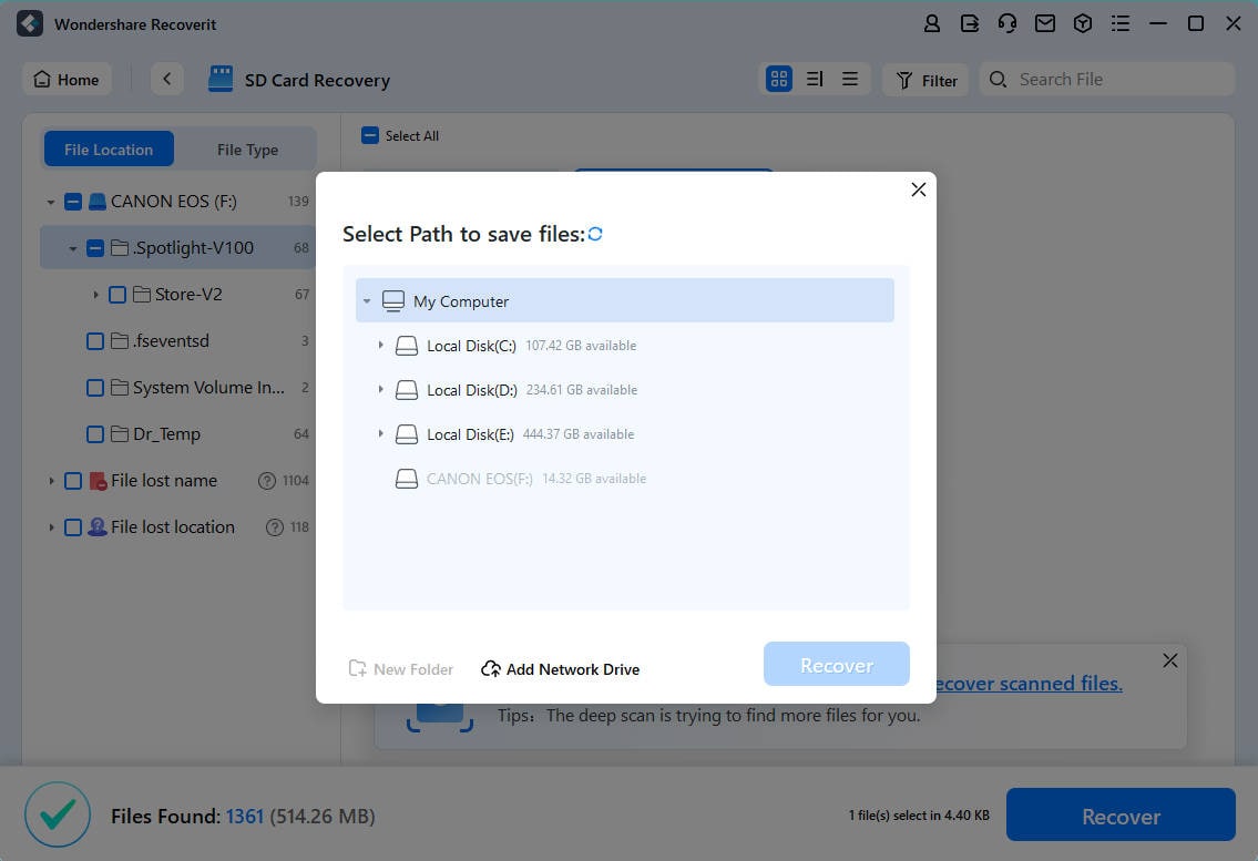
- Download and install Recoverit on your computer. Select the storage device that held your drone imagery.
- Hit Scan. Let the program scan for lost files.
- Preview the found drone imagery files.
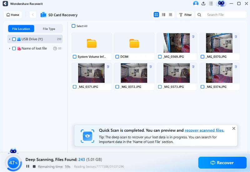
- Select and recover the drone imagery you need.
Related Video >>: How to Recover Files from Drone SD Card?
Part 6: Tips to Make the Most of Drone Imagery Services
Drones have opened up a world of possibilities with their ability to capture stunning aerial images and videos. Here are some tips to make the most out of drone imagery services:
- Understand Your Needs: Define what you need the drone imagery for—real estate, agriculture, event coverage, inspection, or another purpose. This helps you choose the right service provider and equipment.
- Choose the Right Provider: Look for a reputable drone service provider with experience in your specific field. Check their portfolio, reviews, and certifications.
- Get the Right Permits: Ensure all necessary permits and permissions are in place, especially if you plan to fly in restricted areas or over private property.
- Plan Your Shots: Discuss your vision and goals with the service provider. Planning the shots in advance can save time and ensure you get the desired results.
- Consider Timing and Weather: The time of day and weather conditions can greatly impact the quality of your drone images. Early mornings and late afternoons often provide the best lighting.
- Optimize Camera Settings: If possible, tweak camera settings like resolution, frame rate, and exposure to suit your needs. High-resolution images are ideal for detailed analysis, while lower resolutions might be sufficient for general purposes.
- Leverage Post-Processing: Post-processing can enhance your drone imagery. Editing software can correct colors, remove unwanted objects, and create a more polished final product.
- Understand Regulations: Stay informed about local drone regulations to avoid fines and legal issues. This includes altitude limits, no-fly zones, and privacy laws.
- Use Technology: Utilize advanced technologies like GPS, GIS, and 3D mapping to get more value from your drone imagery.
- Regular Maintenance: Ensure that the drone used is well-maintained. Regular maintenance can prevent malfunctions and improve the quality of the imagery.
By keeping these tips in mind, you can harness the full potential of drone imagery services for your projects.
Conclusion
Drone imagery has changed how we see and understand our world. From construction to farming to real estate, drone imagery services offer valuable new views. Whether you need thermal imagery drone scans or basic aerial photos, drones make it possible.
Aerial imaging with drones will keep growing as technology improves. Better cameras, longer flight times, and smarter software will make drone imagery even more useful. As rules for flying drones get clearer, more businesses will use aerial imagery drones.
If you haven't tried drone imagery yet, now might be the time. Drone imagery services are affordable and available in most areas. The benefits of seeing your property or project from above are clear. Drone imagery gives you information and views you can't get any other way.
Try Recoverit to Recover Lost Data from Drone SD Card
![]() Security Verified. Over 7,302,189 people have downloaded it.
Security Verified. Over 7,302,189 people have downloaded it.
FAQ
-
What is the best weather for drone imagery?
Clear days with light winds work best for drone imagery. Strong winds make drones hard to control. This affects image quality. Cloudy days create flat lighting. Rain can damage drone equipment. Early morning often has the calmest air. Sunset gives warm, attractive lighting. Avoid midday for the best results. Season changes affect what drone imagery shows. -
How high can drones fly for aerial imaging?
Most countries limit drone height to 400 feet (120 meters). This height works well for most aerial imaging needs. Lower flights give more detail in drone imagery. Higher flights cover more area at once. Commercial drone imagery services follow local rules. Special permits allow higher flights in some cases. The right height depends on what you need to see. -
What's the difference between a regular drone and a thermal imagery drone?
Regular drones have normal cameras. They take photos and videos we can see with our eyes. Thermal imagery drones have special heat-sensing cameras. They show temperature differences as colors. Thermal imagery drones cost more than regular ones. They need special training to use well. Regular drones work in daylight. Thermal imagery drones work day or night.
 ChatGPT
 Perplexity
 Google AI Mode
 Grok
Grok


